
|
The valley has been suffering some nasty air quality the past week or so as a result of the massive fires up north, the Carr Fire in Redding and the Mendocino Complex Fires (River and Ranch)--and perhaps the Ferguson fire in Yosemite as well--have been sending smoke our way making the days hazy and gray. A few nights ago when I went out for a walk, the smell of smoke was thick in the air and the moon was orange from the smoke still lingering in the sky. 
0 Comments
Sunflower season is here again, and the blooms are big and bright along Poleline Road. Though my car is proving too unreliable to risk heading to the volatile County Fire (which I had rather wanted to shoot), I contented myself today shooting the sunflowers in Davis against a smoky sunset backdrop. 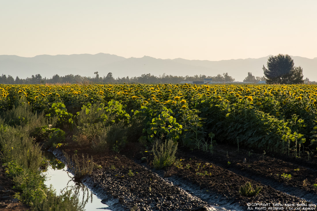 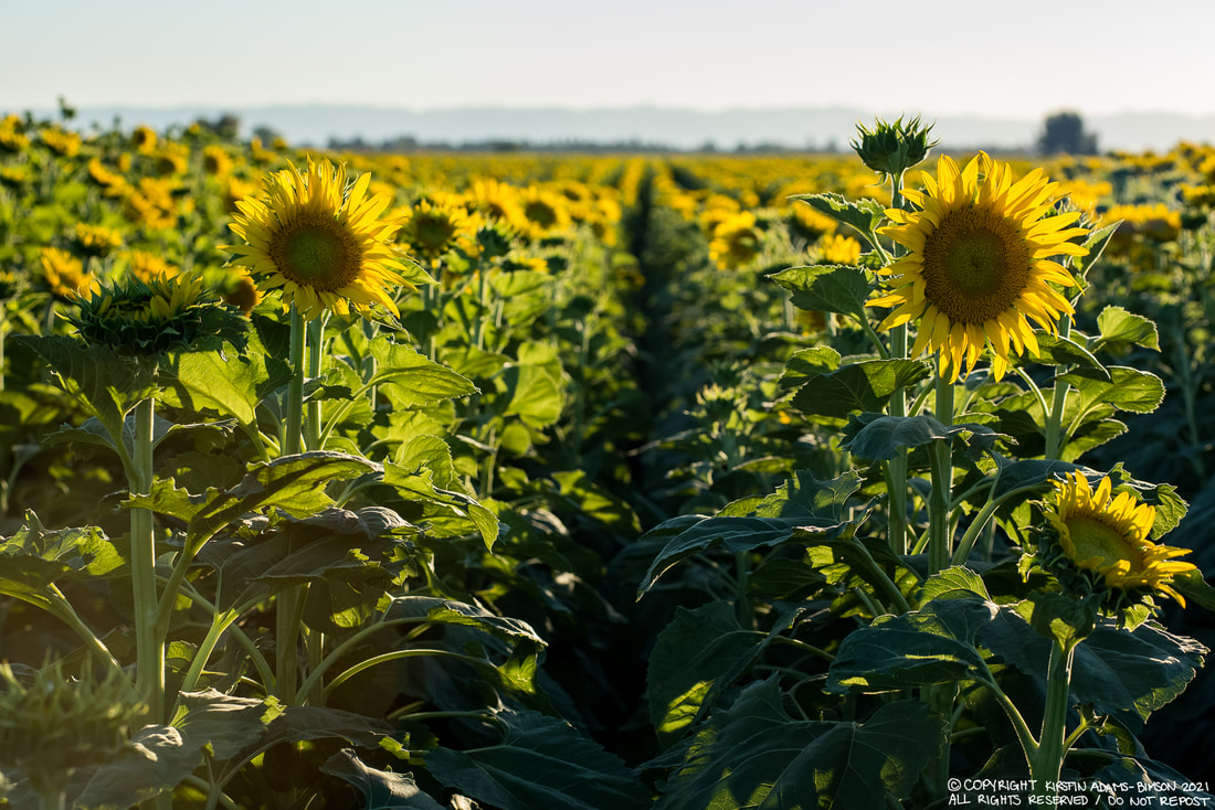   These ones are big. The Atlas fire (east and south of Napa, currently moving towards the outskirts of Fairfield), the Nuns fire (between Sonoma and Santa Rosa, eating up Annadel State Park), and the Patrick fire (not pictured here), have all been grouped into the Southern LNU Complex fire as they're burning simultaneously and starting to merge together. I also shot what remains of the Coffey Park neighborhood in Northern Santa Rosa, destroyed by the Tubbs Fire. These were taken between about 11am and 6pm. The early afternoon seemed a bit more controlled, but things started jumping around by late afternoon. Its a very fluid situation--a lot is happening quickly, some of it anticipated, some of it not. Road closures were constantly shifting all day as a result of fickle winds and rapidly changing conditions. By the time I headed home after sunset things were heating up again. The Atlas fire seems to be the most active if my drive through Fairfield and Vacaville was any indication. We're due for more dry, windy conditions tomorrow, so we shall see what the day brings. 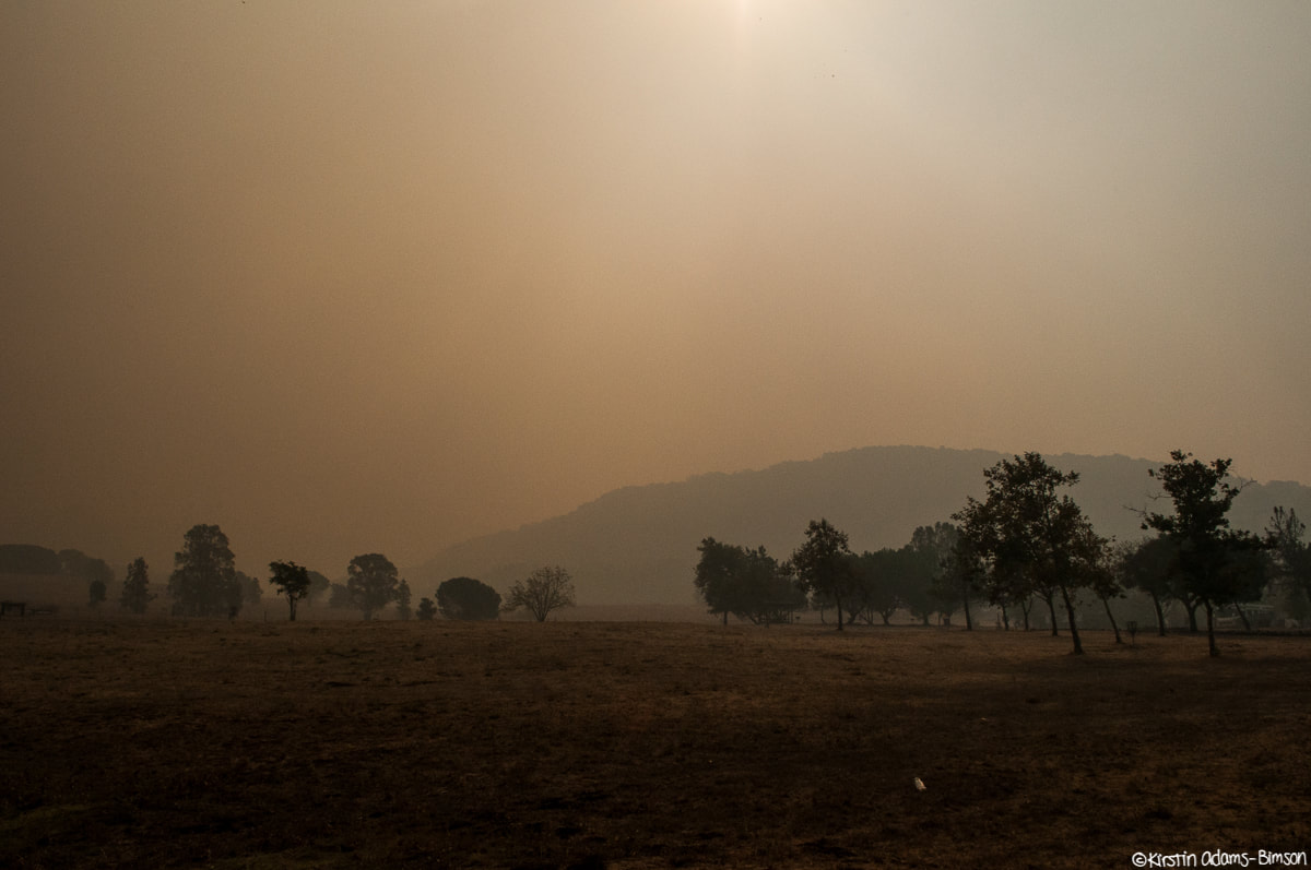 The view from Skyline Park in Napa. Smoke from the Atlas fire here was thick as mud, settling into the valleys between the hills.
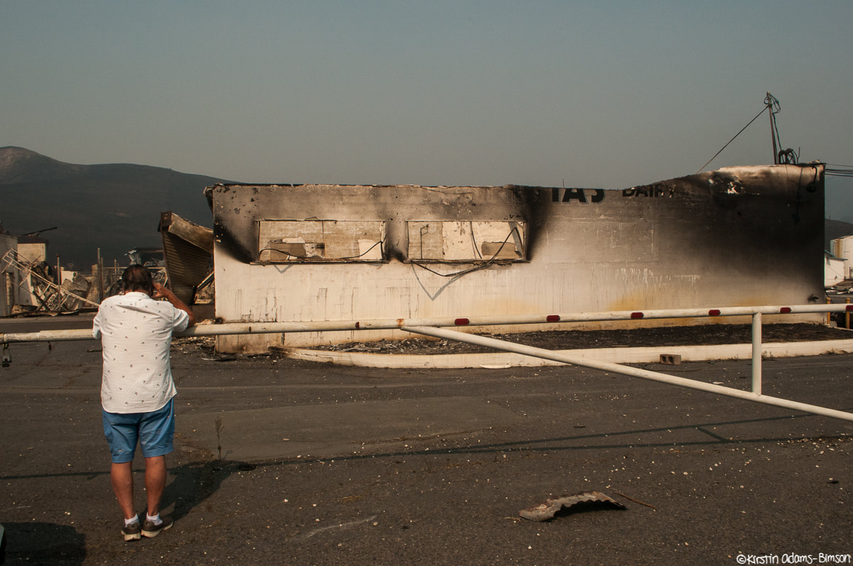
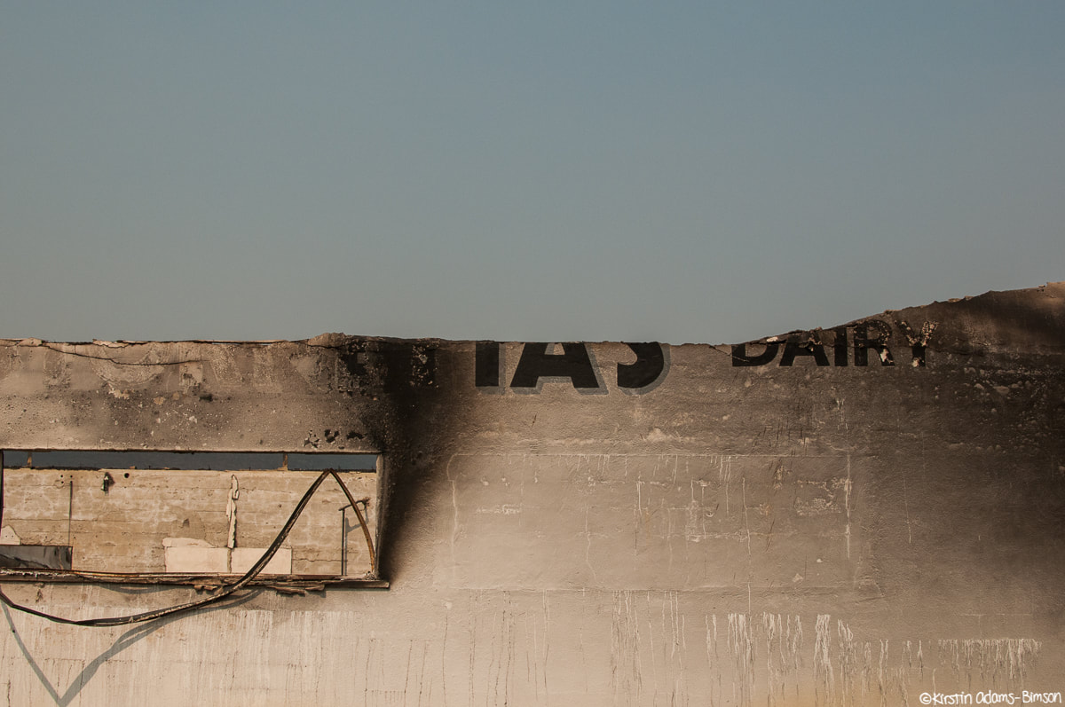
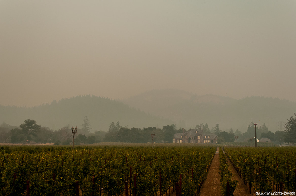
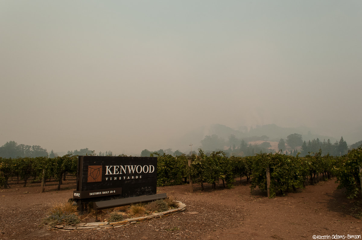
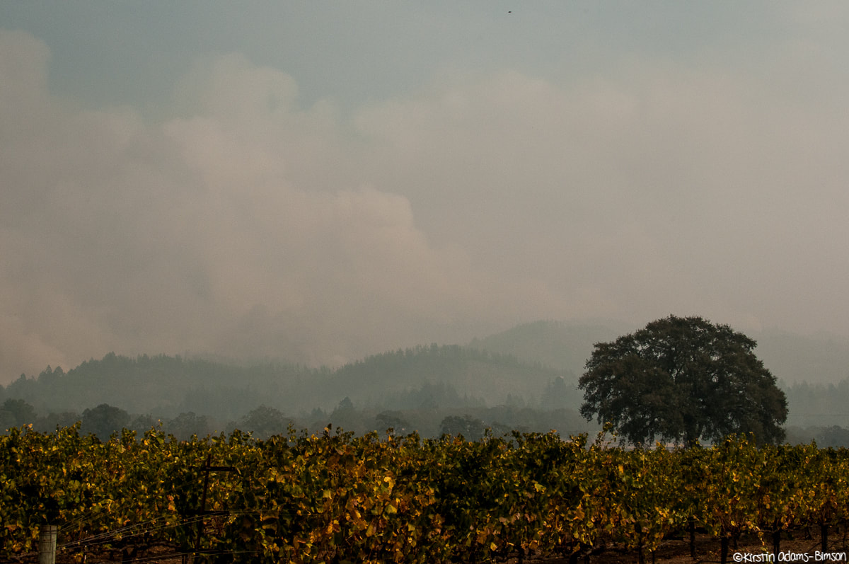
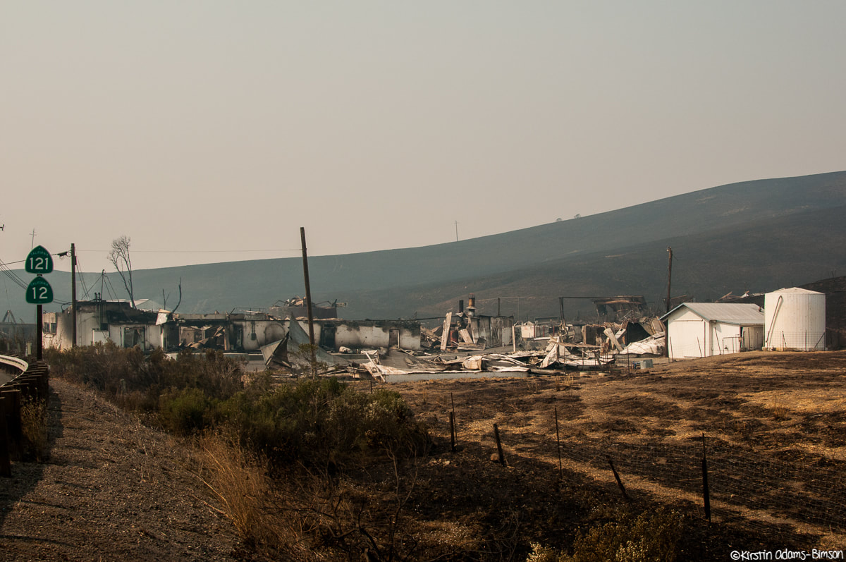 What remains of the Iconic Stornetta Dairy on Highway 12 isn't much. People pulled over frequently to stop, stare, and photograph. 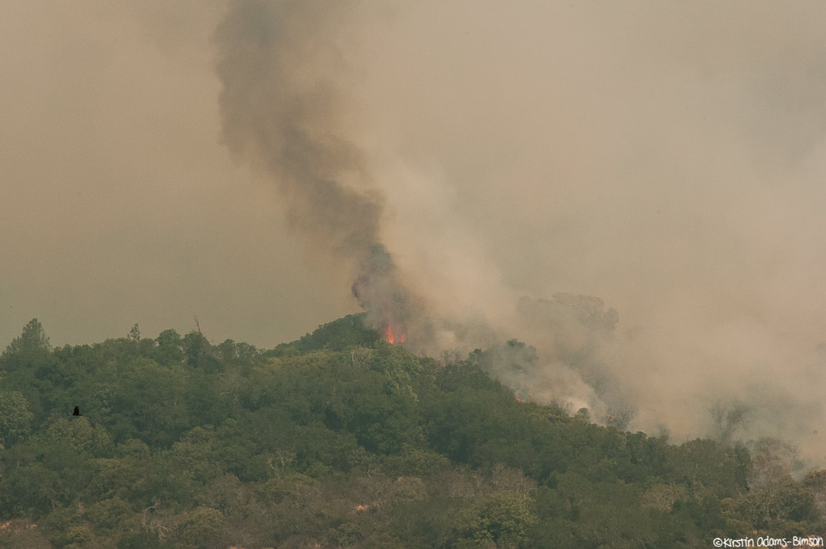 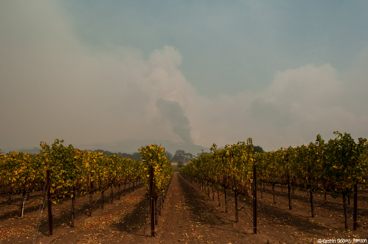 Major activity in the hills north of Highway 12 in the early afternoon; here, as seen through vineyards. 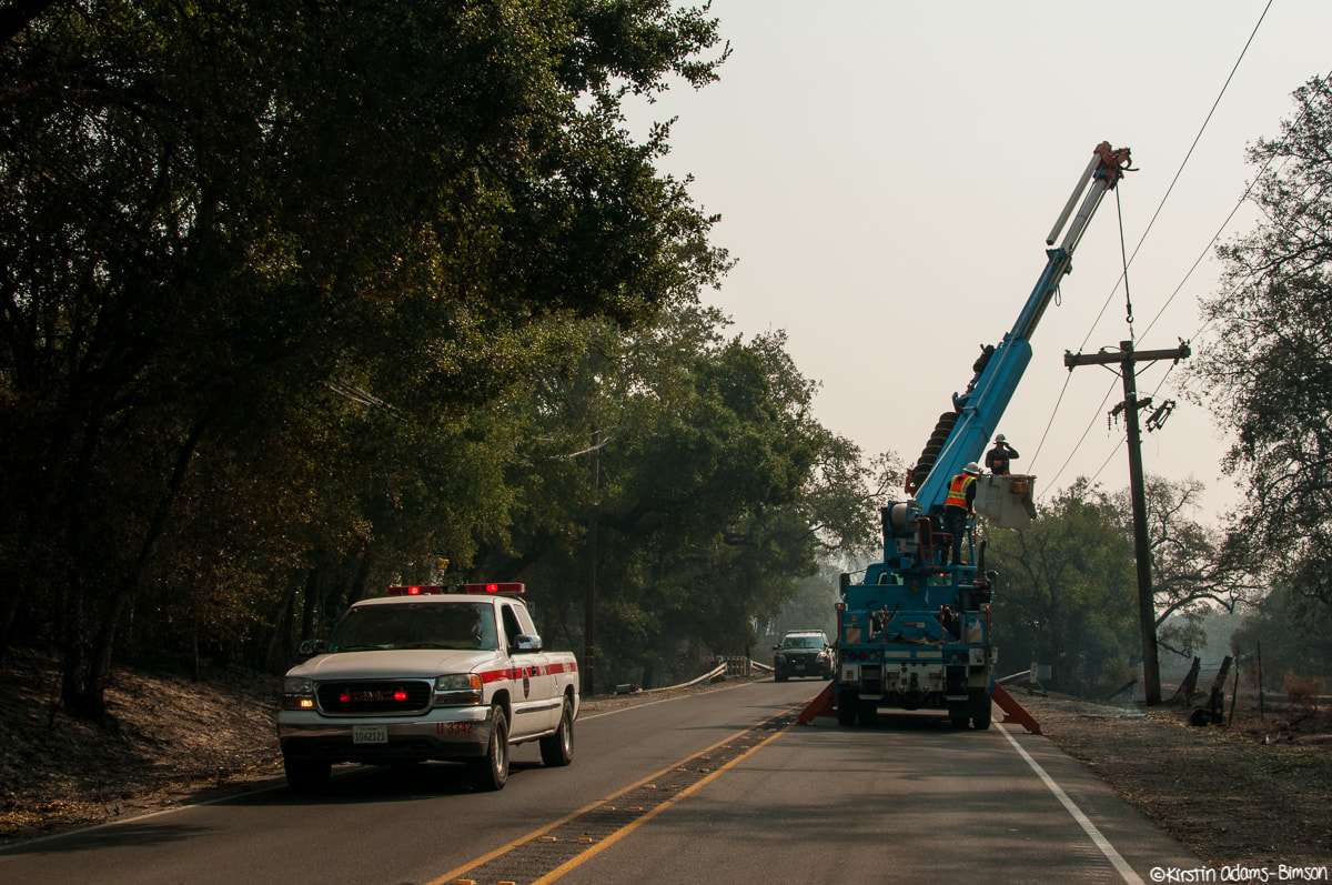 Always a good thing to see: PG&E hard at work repairing power lines along highway 12, where many lines were downed by flames. 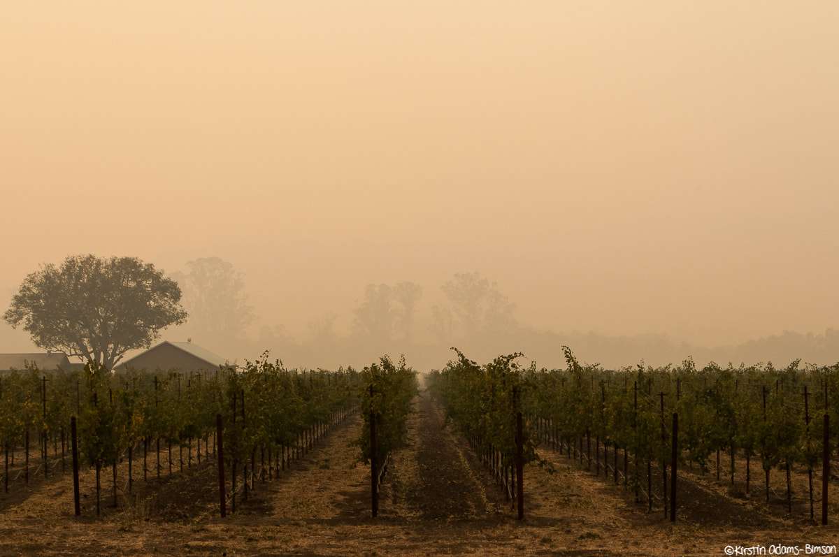 Pockets of heavy smoke reduced visibility to a half mile in places along the highway, like this vineyard along highway 12.
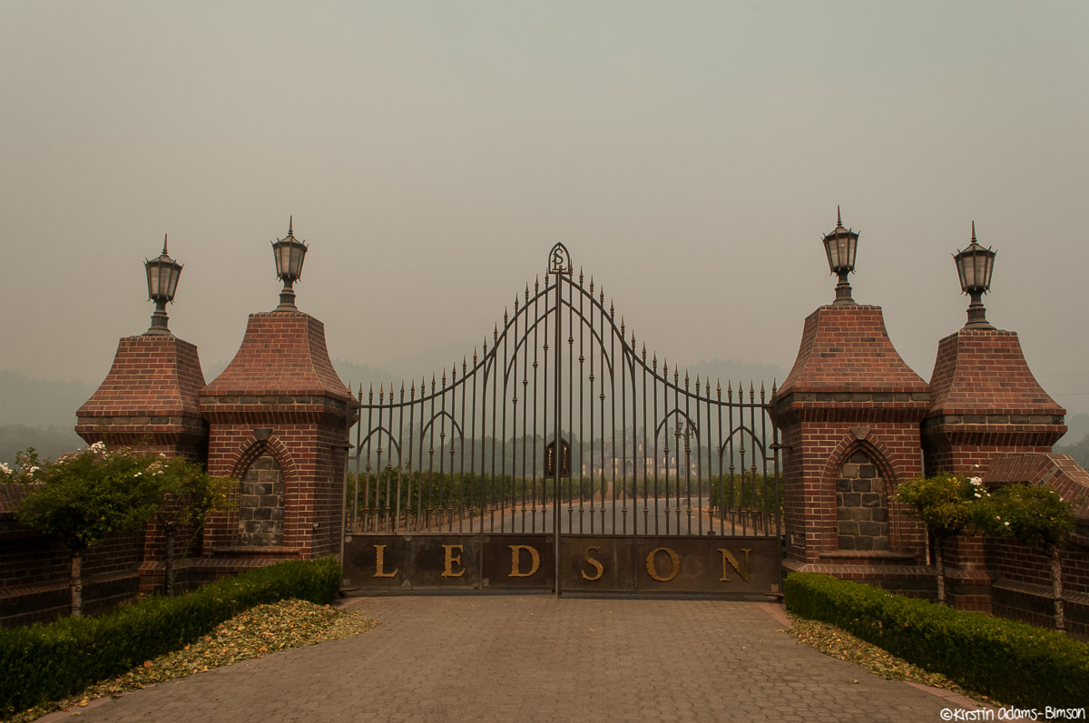
A lot of the prominent Highway 12 wineries are going to have some smoky grapes this year. To my knowledge, both of these have remained safe, despite backing up to the hills where there was prominent activity this afternoon.
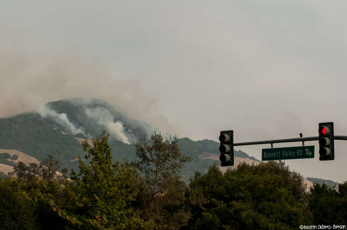
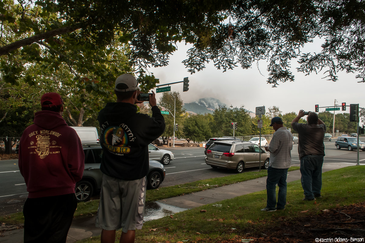
The Nuns fire started burning on the other side of the ridge, prompting evacuations in both the Oakmont and Bennet Valley neighborhoods. Shots taken at the start of the evac order, as officers drove up into the valley to knock on doors. 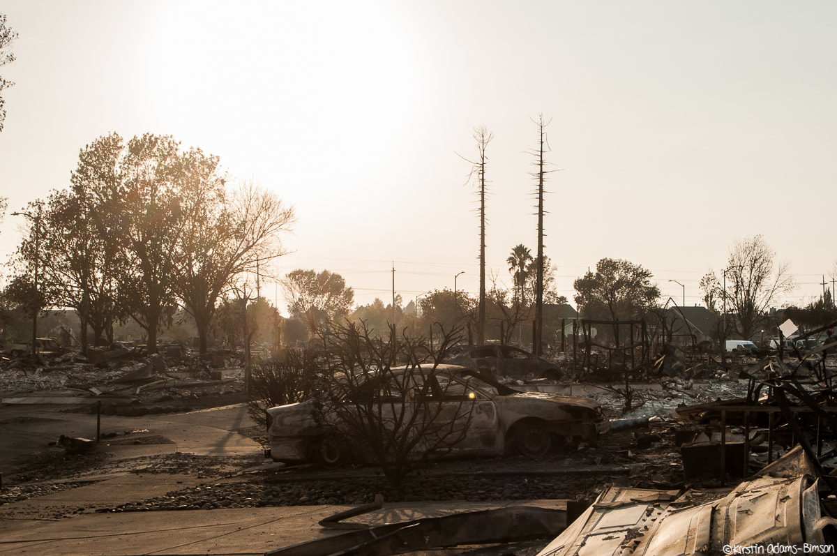 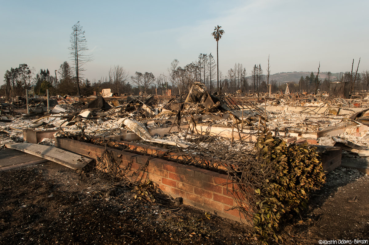 This is the Coffey Park neighborhood in Northern Santa Rosa. Most have seen it as that aerial shot of a flattened neighborhood. This is it. The aerial photo is astounding in its own right, but even still it doesn't quite prepare you for how VAST this area is, when you're there on foot. As much as I tried I really don't think I did it justice. I was there around sunset, and with the extra yellow golden glow it really looked like a the fringes of a nuclear blast zone.
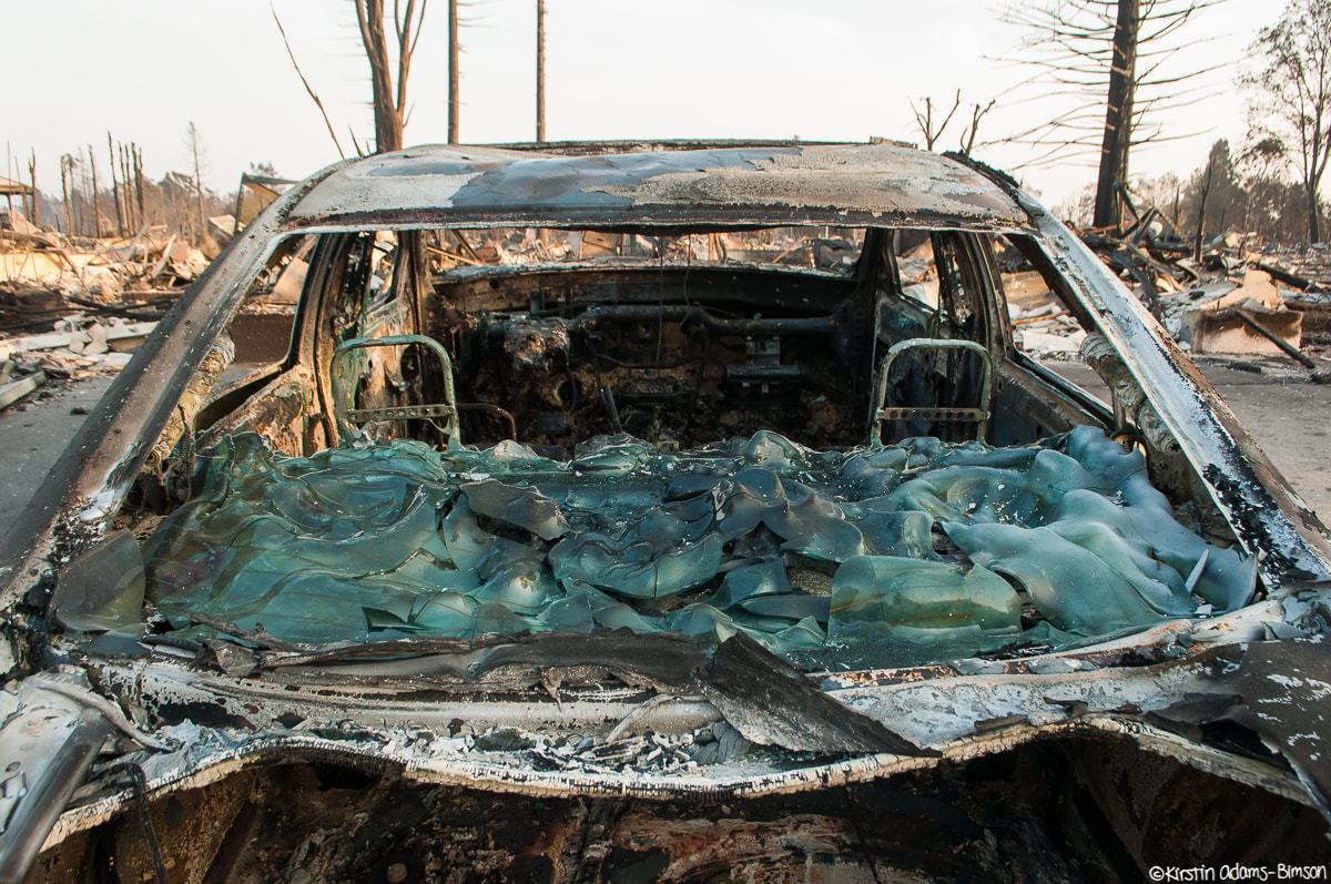
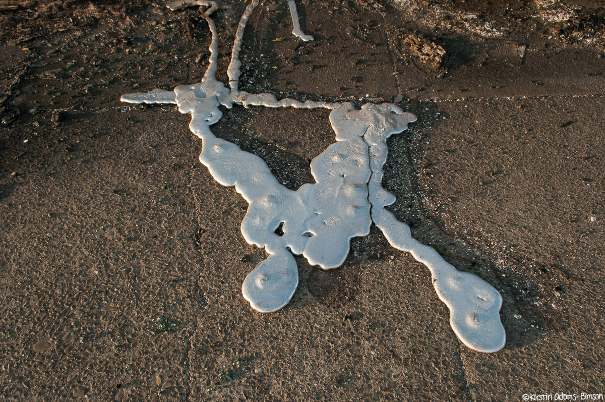
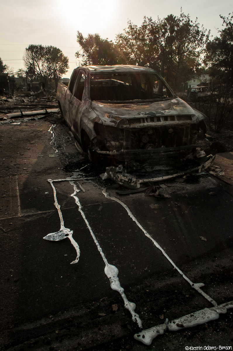
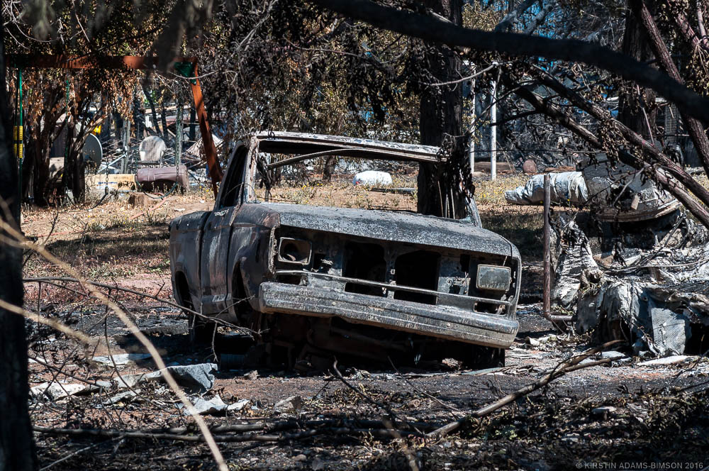
Here we have the rear windshield of a blown-out car, shattered from the heat, then melted together on the rear of the vehicle (L/T). Then we have the melted metal refuse of a blown-out car--not the same one--which pooled on the sidewalk in the heat of the fire (R/B). 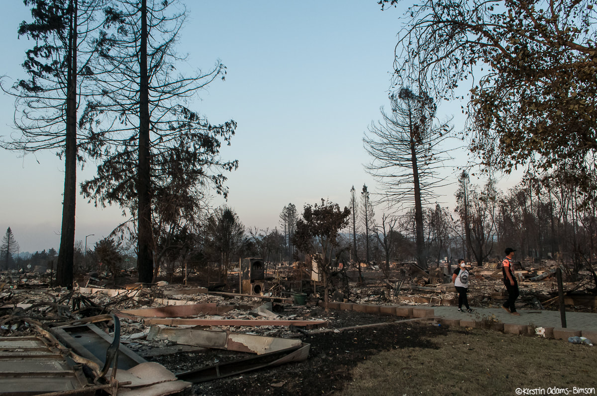 People were just starting to come back through the neighborhood in the evening to dig through rubble and assess damage (as these two were).
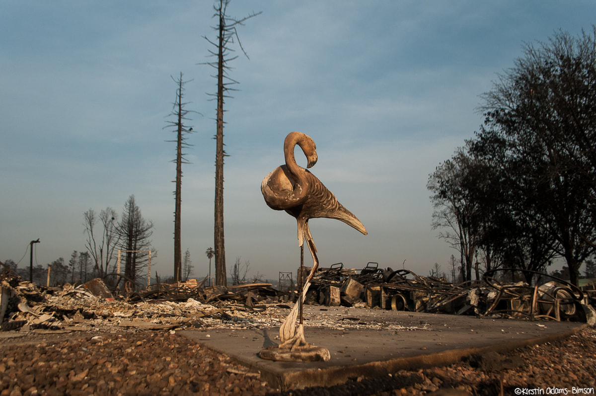
Detail shots of the damage in Coffey Park. Its eerie how certain things that survive--like this flamingo statue--speak so strongly of the life that was once there, and yet still you're forced to face the reality of the level of destruction by virtue of what surrounds you. It's uncanny. 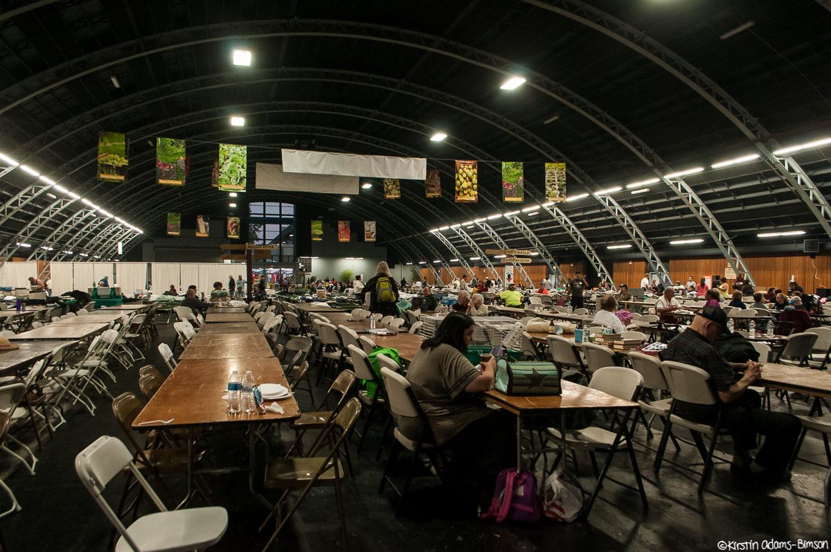 As Curfew nears, evacuees gather in the Sonoma County Fairgrounds, which has been transformed into an evacuation shelter by the Red Cross. Bit jarring to see it juxtaposed with fair banners. If you are a news agency and would be interested in using any of these photos, please contact me, or visit my editorial gallery.
My newest exhibit, "A Climate Change" explord the effect of climate change on the planet as well as on the climate of daily life. It's now up at the Putah Creek Winery tasting room in downtown Davis and will be up through May 8th! If you didn't get a chance to see it at the opening night reception, make sure to swing by. A self-guided tour booklet is available by the entrance. 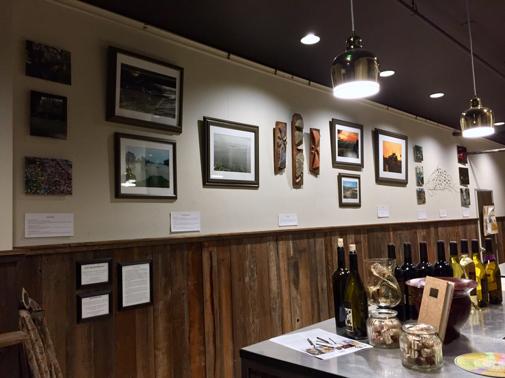 Putah Creek Winery downtown tasting room
110 F Street, between F street market and T-Mobile Davis, CA 95616 Hours: Mon-Tues: 4:00-7:00pm Wed-Sun: 12:00-7:00pm The recent Clayton fire in Lake County tore through the community of Lower Lake in Lake county, destroying over 150 structures including many in the historic downtown. Hundreds of residents were evacuated. A 40 year old Clearlake resident, Damon Pashilk, was arrested under suspicion of arson which has grievously angered an already stressed community as visions of last year's Valley, Jerusalem, and Rocky fires bring back painful memories and worries of the future. Yesterday, Tuesday, August 16th, I drove into Lower Lake's historic Main street to photograph the damage and recovery efforts. Lake County If you are interested in donating to help victims of the Clayton fire, please see: Lake Area Rotary Club Assn. | Lake County Rising | North Coast Opportunities Redwood Credit Union | The Salvation Army
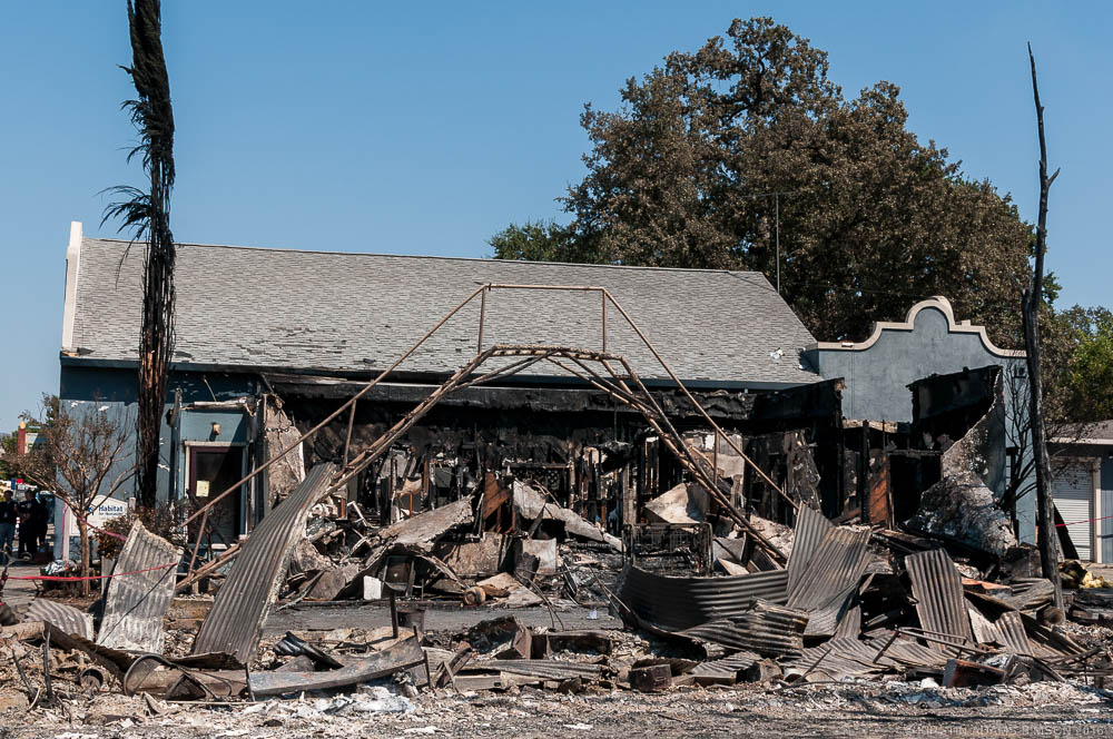
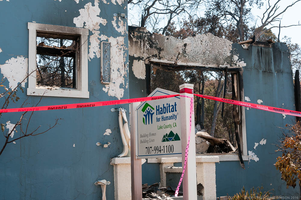 The Habitat for Humanity building on Main Street in Lower Lake, CA was devastated by the Clayton Fire, with only one badly damaged wall still standing on Tuesday, August 16th. The group had been working to raise funds to help families rebuild from last year's Rocky, Jerusalem, and Valley fires which devastated the region. 2016.
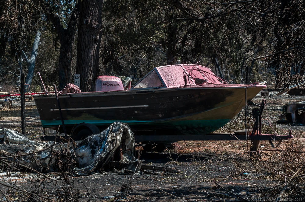
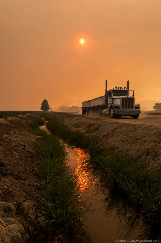
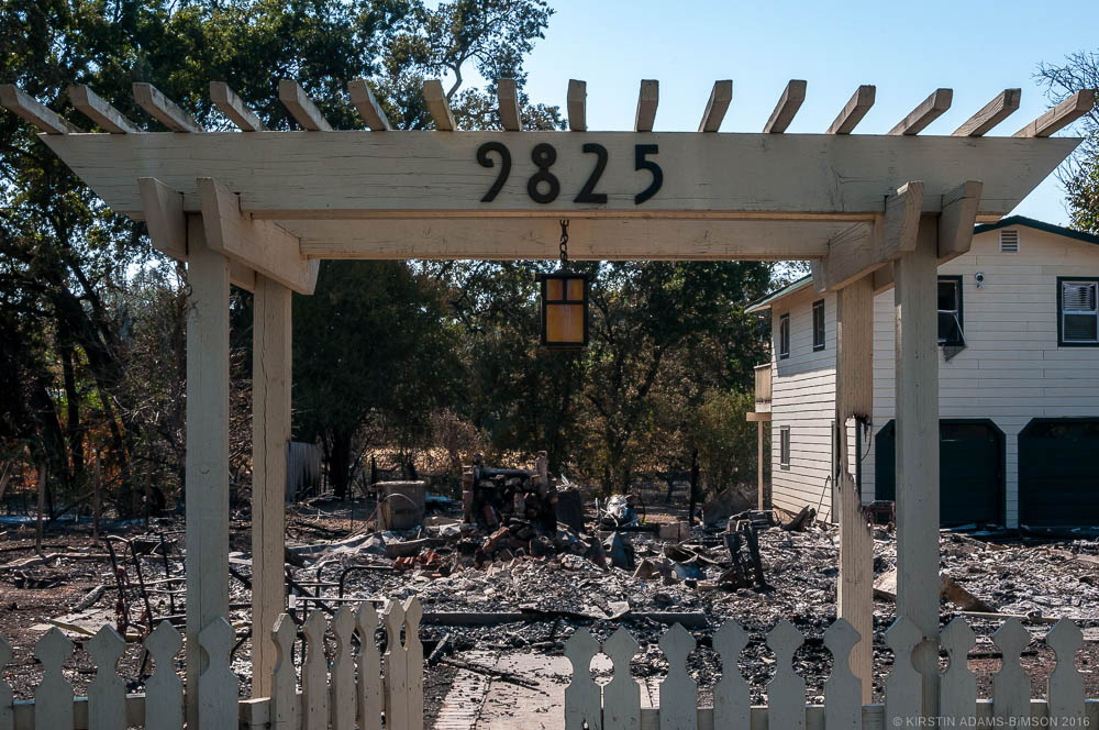 The gateway to a home on Lake street frames the debris of the home itself, which was destroyed by the Clayton fire. August 16th, 2016. 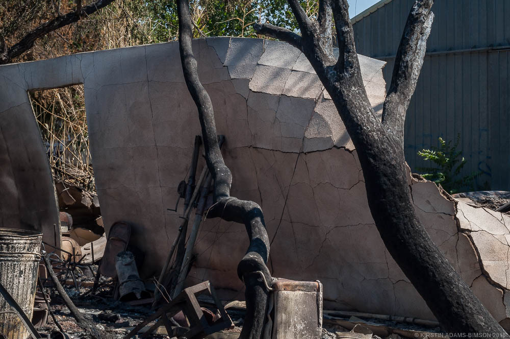 The cracked and collapsing wall of a garage leans heavily against trees scorched by the Clayton fire on Second Street in Lower Lake, CA. August 16th, 2016. The Cold Fire between Lake Berryessa and Winters continued today, moving northerly and growing from 2,200 acres at 6:00am this morning to 4,600 acres by 7:00pm this evening. Mop-up efforts took place along 128 throughout the day, as firefighters battled the fire's northward movement. 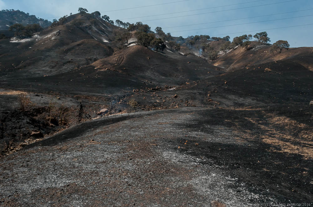 Land to the north of highway 128, west of Winters, has been scorched by the ongoing Cold Fire. Yolo County, CA - August 3rd, 2016. 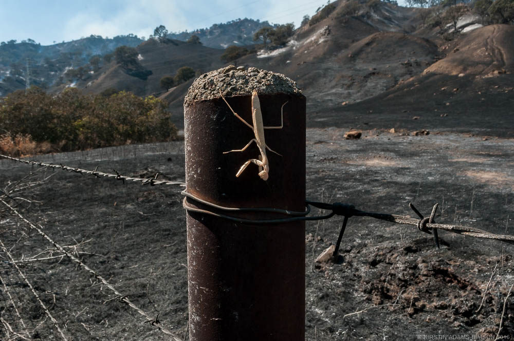 A large praying mantis hangs to a post on the border of highway 128 and land scorched by the ongoing cold fire, standing out vividly against the charred metal pole. Yolo County, CA - August 3rd, 2016. 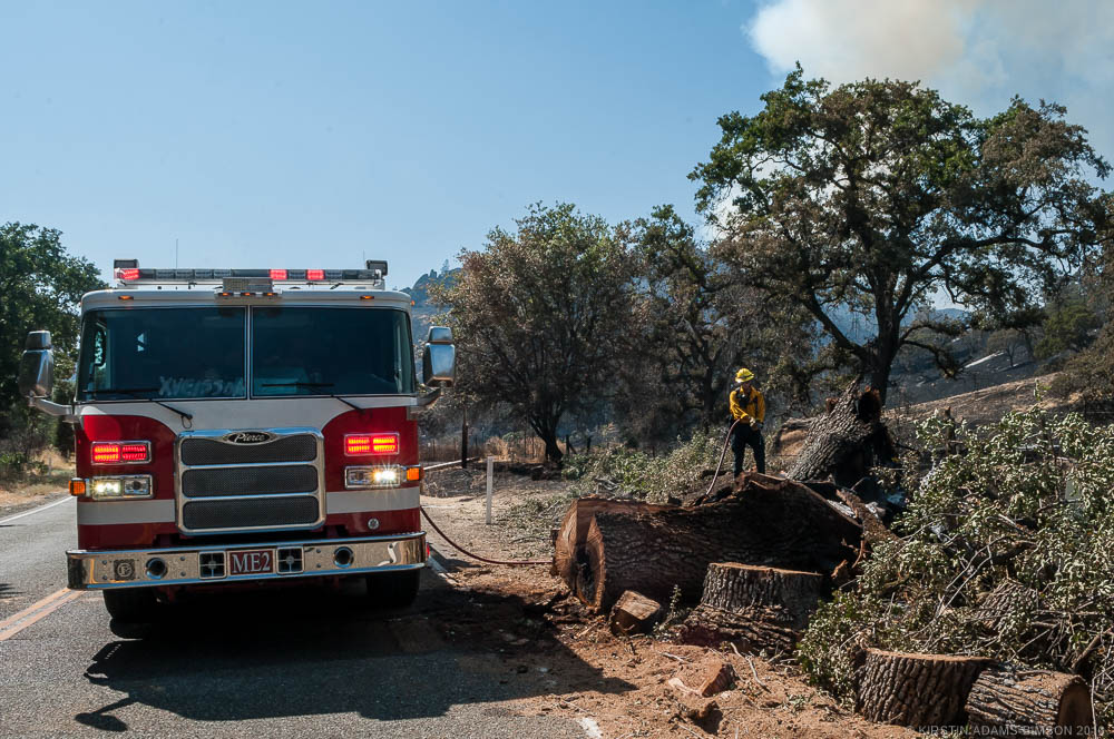 Firefighters battling the Cold Fire in Yolo County continue mop-up efforts along highway 128 mid-day on Wednesday, in an effort to maintain the fire line. August 3rd, 2016. 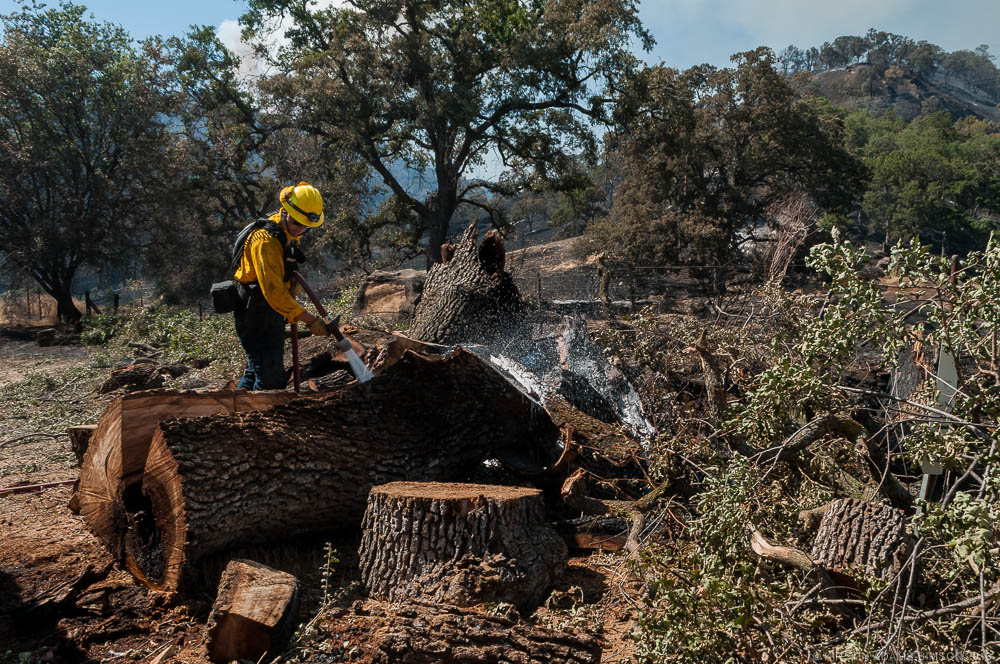 Firefighters battling the Cold Fire in Yolo County continue mop-up efforts along highway 128 mid-day on Wednesday, in an effort to maintain the fire line. August 3rd, 2016. 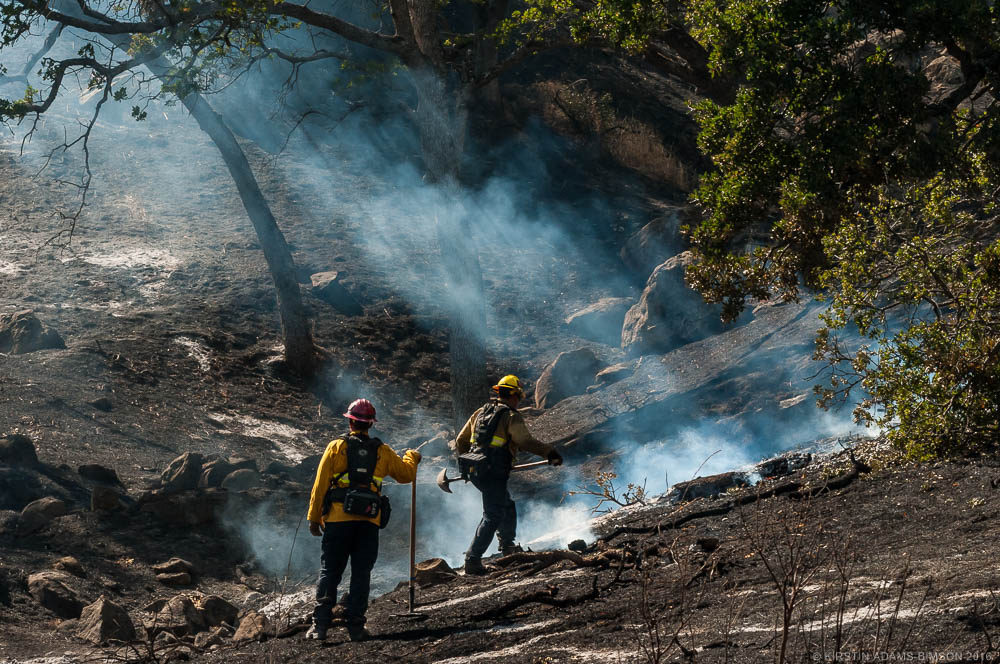 Firefighters from the Oxnard fire department work on mopping-up hot spots along highway 128 on the Audubon Bobcat Ranch, west of Winters. Yolo County, CA - August 3rd, 2016. 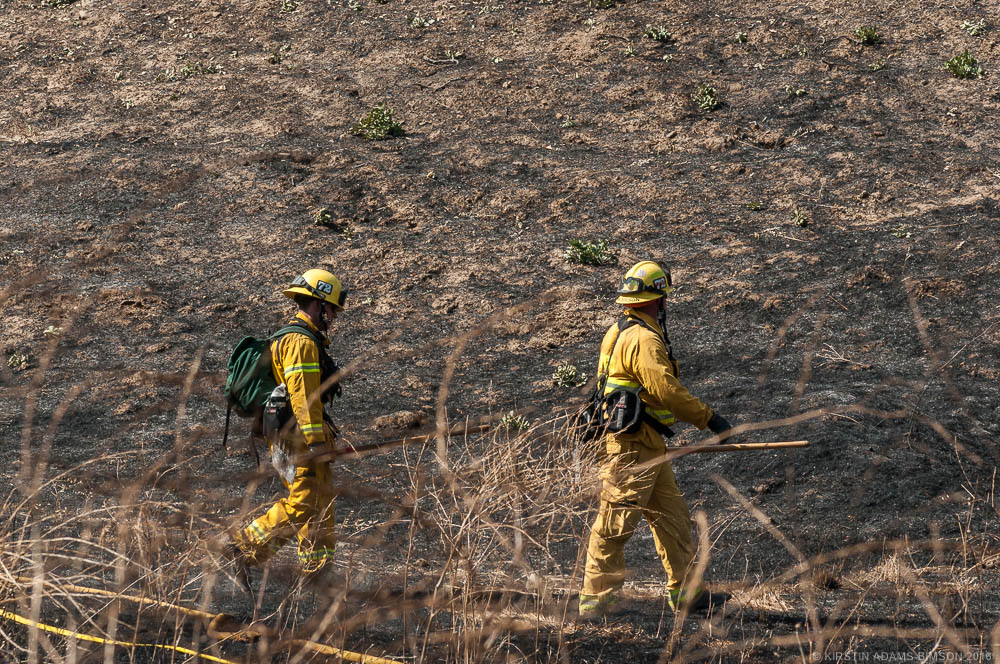 Firefighters battling the Cold Fire in Yolo County scout land north of highway 128 mid-day on Wednesday, in an effort to mop-up hot spots and maintain the fire line. August 3rd, 2016.
If you are a news agency and would be interested in using any of these photos, please contact me, or visit my editorial gallery.
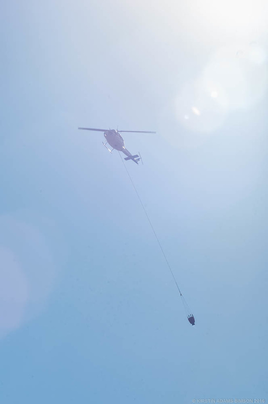
The wildland west of Winters just can't seem to get a break. This afternoon around 4:30pm, a fire broke out east of Lake Beryessa, heading east, and by later this evening, northeast. As of early this evening, The Golden Bear community is under evacuation orders, and the fire has grown from 200 acres late this afternoon to 1,700 acres by 9:00pm this evening. I drove down highway 128 and into to the Golden Bear community. Here are some of those shots. 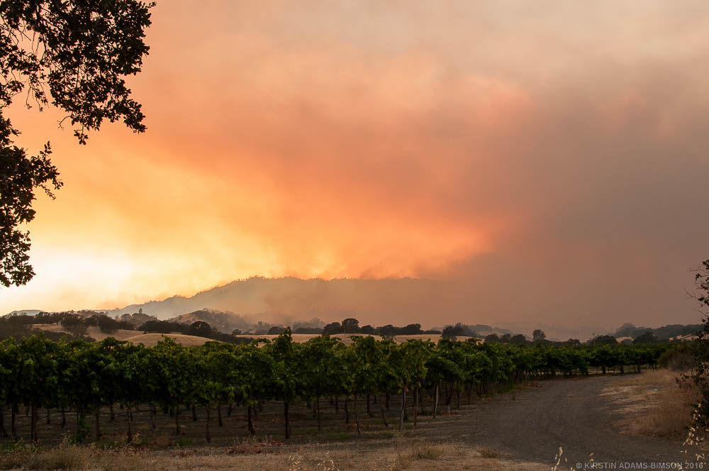 Smoke from the Cold Fire blankets the hills off highway 128 in Winters, with flames becoming visible on a hilltop as the fire grows by the end of its first night to 1,700 acres. August 2nd, 2016. 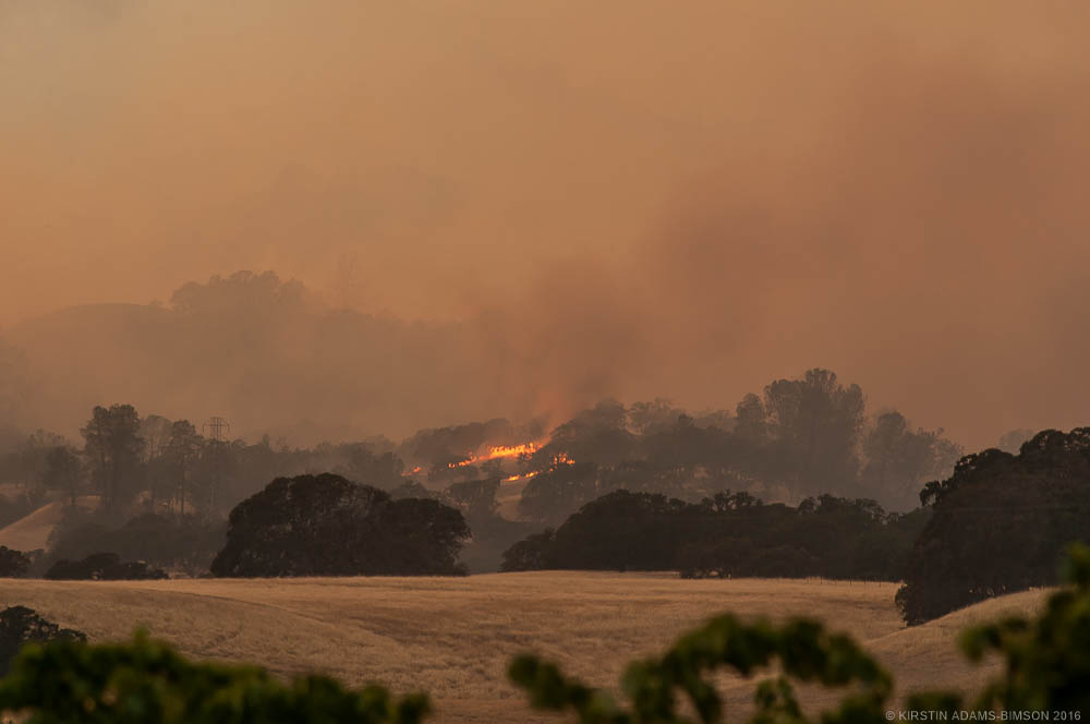 Flames from the Cold Fire rise from the top of a hill off highway 128 in Winters, with smoke blanketing the landscape as the fire grows by the end of its first night to 1,700 acres. August 2nd, 2016. 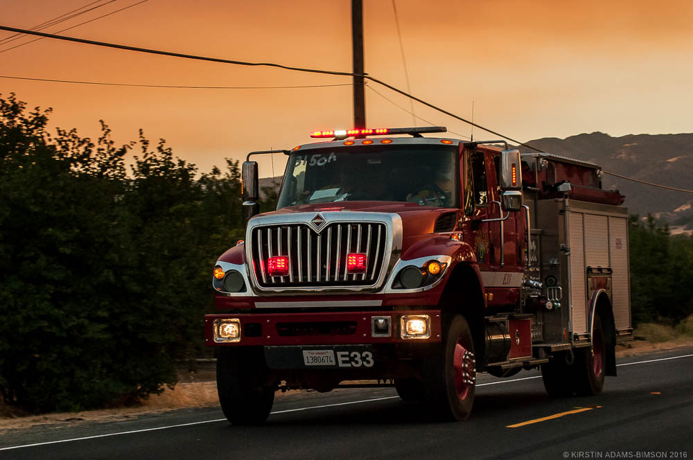 A firetruck drives down highway 128 towards the entrance to the Golden Bear community. Winters, CA - August 2nd, 2016. 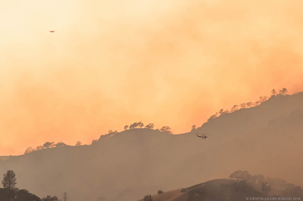 A helicopter and air tanker fly above a patch of flames from the Cold Fire off highway 128 in Winters, CA. August 2nd, 2016. 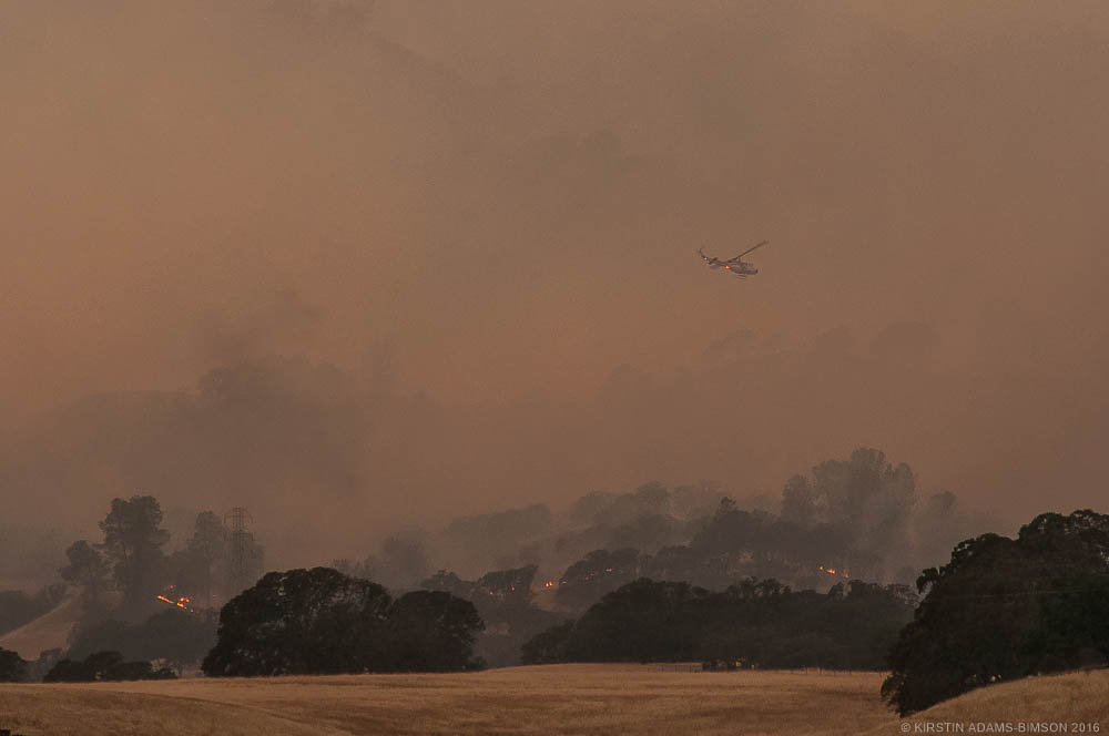 A helicopter circles above a patch of flames from the Cold Fire off highway 128 in Winters, CA. August 2nd, 2016. 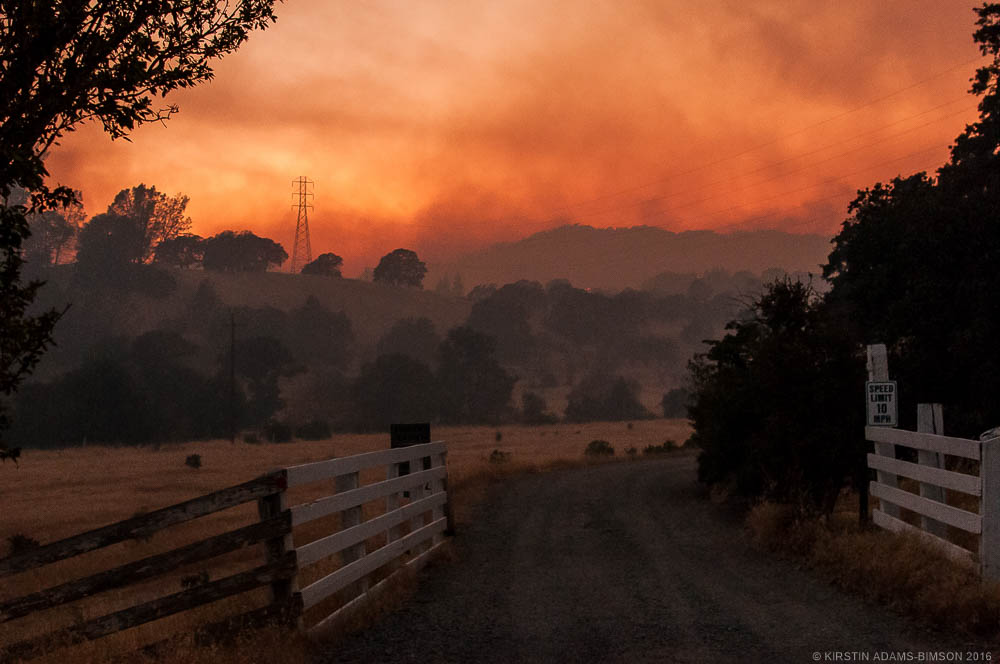 Smoke from the Cold fire blankets hills in the Golden Bear community, as the wildfire grows rapidly on its first night to 1,700 acres. Winters, CA - August 2nd, 2016. 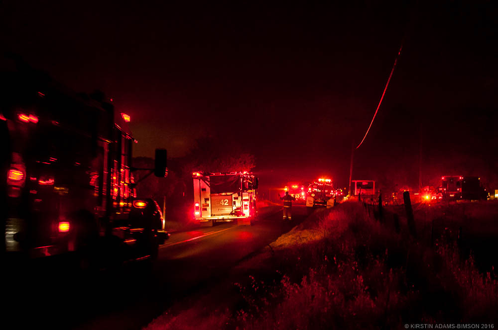 Firetrucks and other emergency vehicles disperse throughout the Golden Bear community as the Cold Fire rapidly grows on its first night. Winters, CA - August 2nd, 2016. 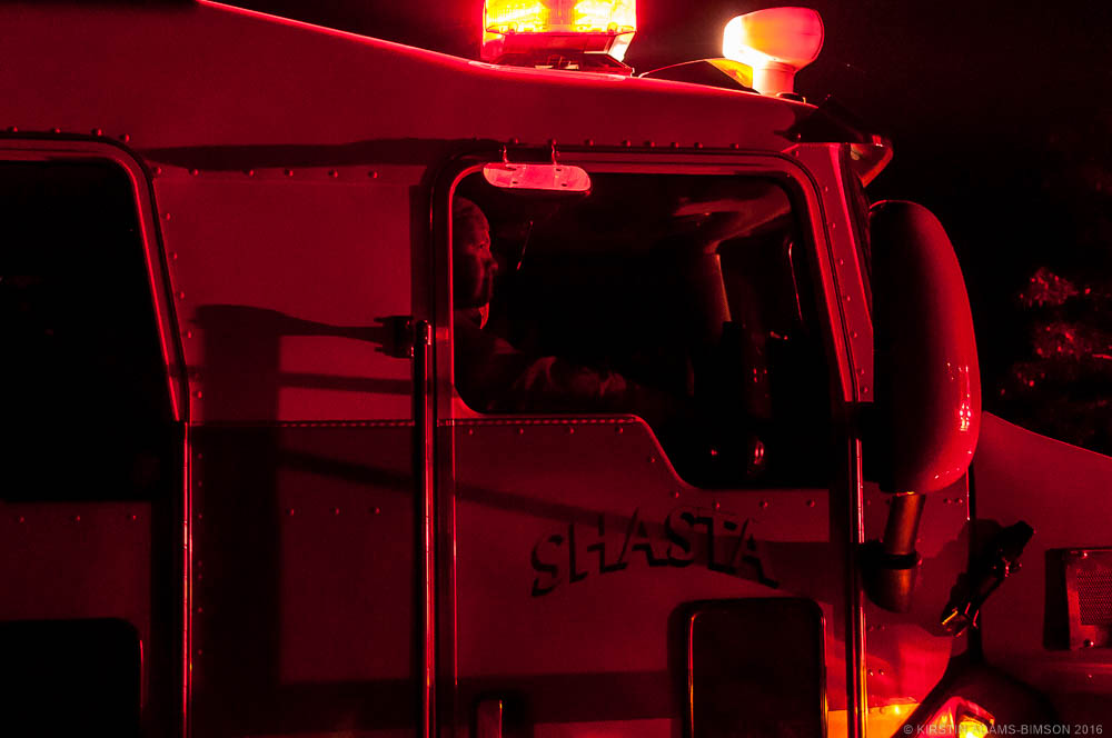 A Firefighter from a Shasta county unit sits in a firetruck on the side of county road 34 in the Golden Bear community awaiting orders as the Cold Fire rapidly grew on its first night. Winters, CA - August 2nd, 2016. 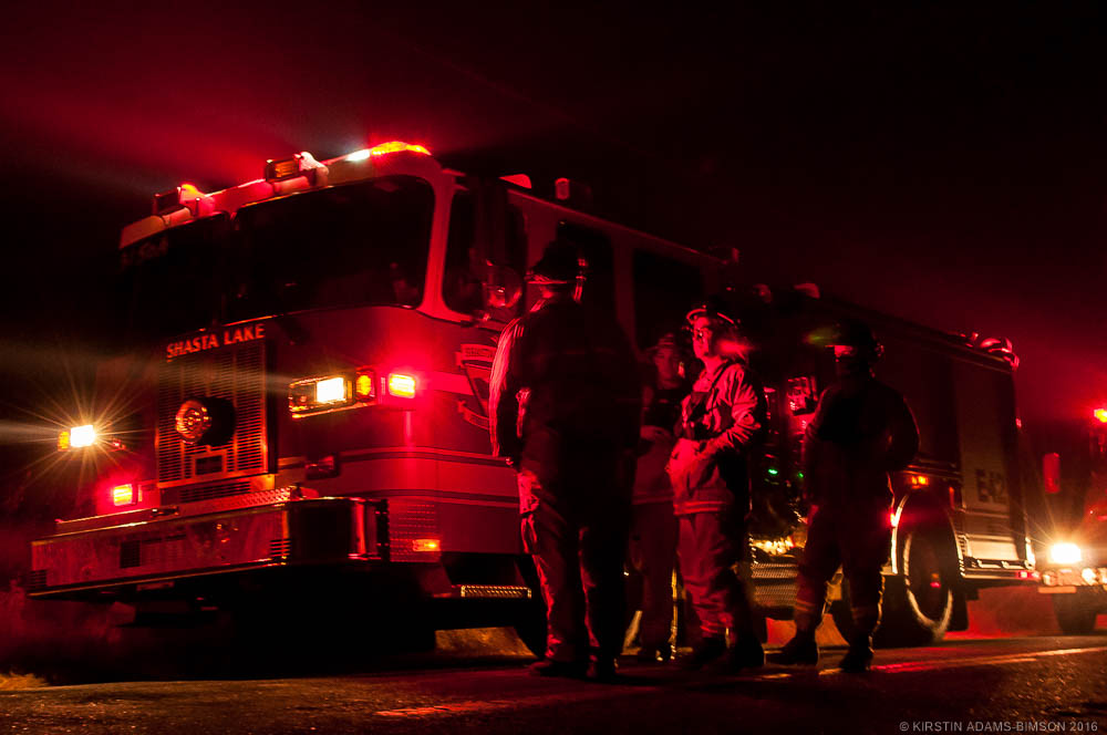 Firefighters working to battle the Cold Fire coordinate on county road 34 in the Golden Bear Community, which earlier in the day received evacuation orders. Winters, CA - August 2nd, 2016. If you are a news agency and would be interested in using any of these photos, please contact me, or visit my editorial gallery.
During July, I covered the Wragg wildfire which raged a week long, south of Lake Beryessa along highway 128, west of Winters. I grew up boating and hiking with my family on the lake and around the Beryessa area, so this fire had a rather personal ring to it for me, though that may be the subject of another piece some other time. While I'm saving the majority of my work for a larger piece on the California Drought, I wanted to share a few of the more remarkable images. At nearly 7,000 acres burned, I thought it would end up being one of the larger wildfires in the region this summer, but not days after the Wragg fire was put out, the Rocky fire started north of Beryessa in Lake county, burning 70,000 acres. Immediately following that, the Jerusalem fire caught--now at 25,000+ acres burned as of writing this--and has merged with the area burned by the Rocky fire. Nearly 100,000 acres burned in Lake County, California alone. Day 1 - Wednesday, July 22 | Davis & Winters 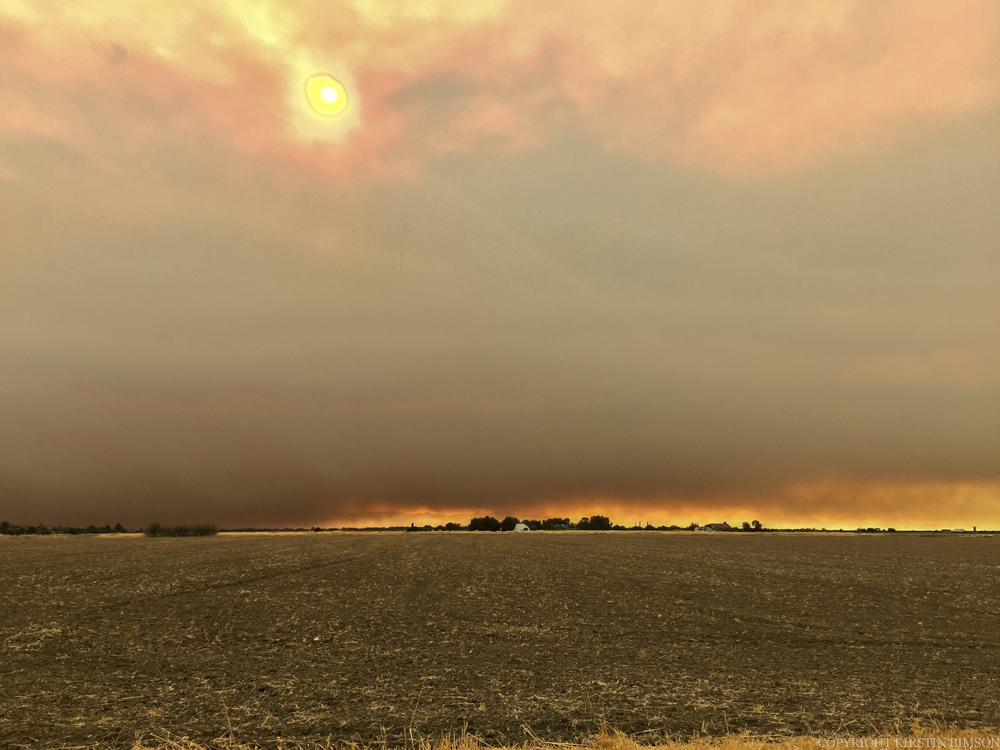 Facing West on the northerly outskirts of Davis, CA. |
Categories
All
Archives
March 2024
|
 RSS Feed